


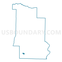
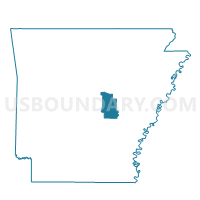
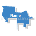
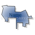
ENGLAND WARD 3, Lonoke County, Arkansas
About
Outline

Summary
| Unique Area Identifier | 527215 |
| Name | ENGLAND WARD 3 |
| County | Lonoke County |
| State | Arkansas |
| Area (square miles) | 0.67 |
| Land Area (square miles) | 0.67 |
| Water Area (square miles) | 0.00 |
| % of Land Area | 100.00 |
| % of Water Area | 0.00 |
| Latitude of the Internal Point | 34.54096350 |
| Longtitude of the Internal Point | -91.97608490 |
Maps

Graphs
Select a template below for downloading or customizing gragh for ENGLAND WARD 3, Lonoke County, Arkansas


Neighbors
Neighoring Voting District (by Name) Neighboring Voting District on the Map
- ENGLAND WARD 1, Lonoke County, AR
- ENGLAND WARD 2, Lonoke County, AR
- ENGLAND WARD 4, Lonoke County, AR
- GUM WOODS Voting District, Lonoke County, AR